Background and study aims
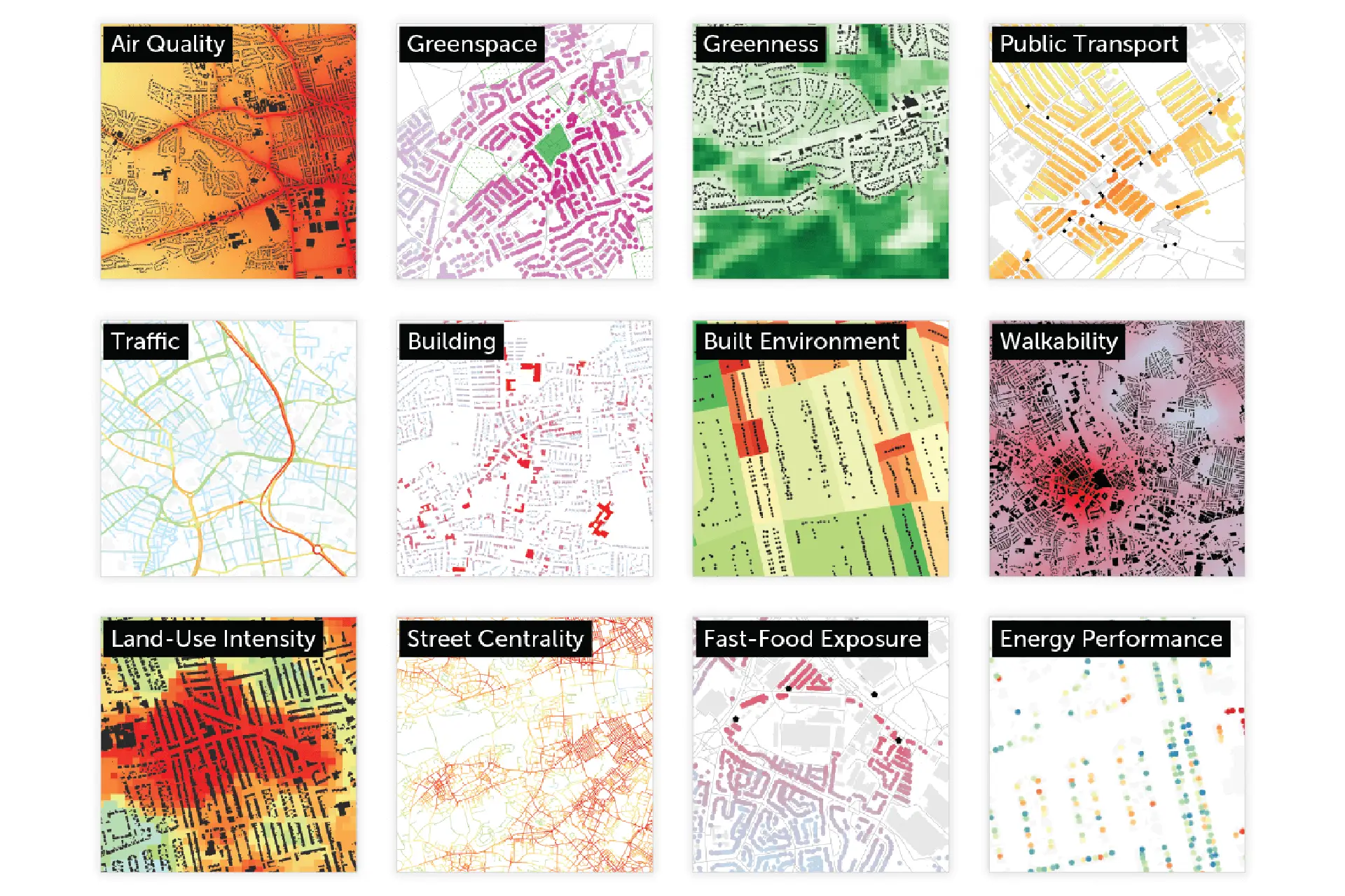
A team of researchers is working on novel ways to measure and simulate the exposure of children to and within the built environment. The aim is to provide a data resource that can capture the features and qualities of every child’s environment. We use a child’s residential address, the location of their school and the neighbourhoods surrounding these to gather environmental information on air quality, noise levels, the amount of traffic, the level of greenness, building density, the availability of parks and public transport, and the number of fast-food outlets, among others.
We then link this data to individual-level health information from the longitudinal cohort survey Born in Bradford alongside data from Connected Bradford, a large database gathering health information from more than 800,000 residents across Bradford. With this rich dataset, we can start to look into relationships between the environment and the health of the city’s children.
Our team, including researchers from UCL (Laura Vaughan, Kimon Krenz) and BIHR, is currently investigating if exposure to fast-food outlets affects children’s weight, a topic of high policy relevance. The next steps include expanding the application to investigate causal relationships between exposure to air pollution and the development of respiratory diseases like asthma in children.